Preparation for a 6000m Peak Climbing
The difficulty of a 6,000-meter peak climb can vary depending on the specific peak and route. As you mentioned, some peaks may require more technical skills such as snow and ice climbing, glacier crossings, and rock climbing. A common rule of progression in the Himalayas can be: 2 mild 6000m peaks will prepare you ready for an easy 7000m peak.
Step 1:
Evaluate the technical difficulties you will encounter on your climb. You should not be surprised by what you find when you get to your destination because there is so much information available online today. Doing your homework will help you succeed.
Step 2:
Acclimate ahead of time by climbing at least 10x-15x to the height of your target base camp. Most climbers from the United States and Europe, however, do not have the luxury of rising higher than 5000m on a frequent basis. Fortunately, the base camp for most 6000m peaks will be between 4000 m and 5000m.
Step 3:
Start with relatively general training at the start of your routine and work your way up to more sport-specific activities as your training cycle progresses.
Step 4:
For a little less technical 6000m peaks, you should have at least 120 hours of aerobic base training in Zone 1. (55-75 percent of your maximum heart rate.) This training load/frequency should be spread out across a minimum of 25-30 days. These training periods will be heavily influenced by your degree of physical fitness when you begin training.
Step 5:
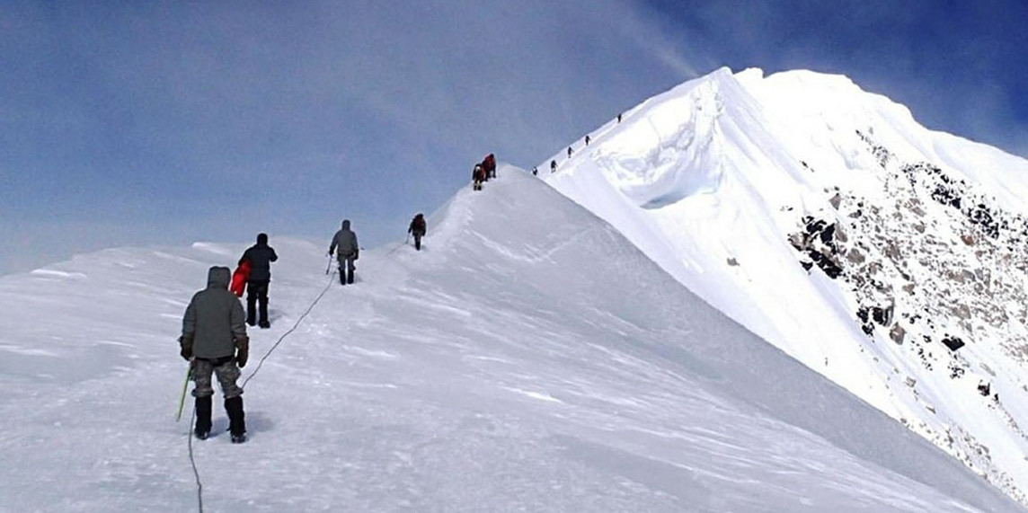
Climbing self-rescue, crevasse rescue training, general mountaineering skills (using an ice axe, crampons, and crossing a glacier), and wilderness medical training are just a few of the capabilities you'll need.
Chulu Far East Peak (6584m/21,601ft)
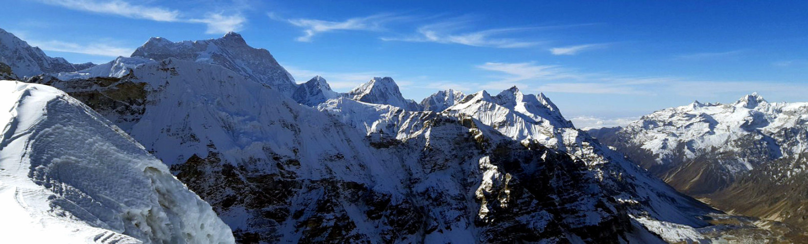
At 28°44'09"N and 84°02'10" E, the Chulu East Peak Ascending (6584m/21,601ft) is situated right north of the Annapurna massif. This objective climbing is second to none in Nepal, because of its gorgeous surroundings, challenging aspects, spectacular 900m ascending route, and quick access to the summit. The Chulurange includes Chulu East 6429, Chulu Far East 6029 m, and Chulu West 6584. Annapurna (I, II, III, and IV), Gangapurna, Glacier Dome, Dhaulagiri, Tilicho Peak, and Mt. Manaslu are all visible from the Peak Chulu East. In 1955, a German team used the Northeast Ridge to climb Chulu Far East for the first time. Dick Isherwood and John Noble used the Northeast Ridge to climb Chulu East for the first time in 1979. It is a component of Manang Himal, which includes both the Chulu East and Chulu West Peaks.
To get to the base camp of Chulu East Peak, you'll need to take private transport overland. You begin your trip after arriving in the settlement of Besisahar, which takes you first into the Marsyangdi Valley. The vegetation and fauna diversity along the trek to Chulu East Peak Climbing is astounding. It will take around a week to travel from Annapurna Base Camp to Chulu Peak Base Camp along the Annapurna Circuit. 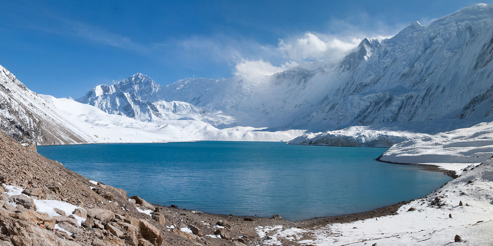
Elevation- (6584m/21,601ft)
Location - Annapurna Region
Grade – moderately difficult
Best Time - Autumn (October-November) and Spring (April-May)
Coordinates - 28°44'09'' N / 84°02'10''E
Himalayan View - Annapurna Massif, Gangapurna, and Machhapuchhre (Fishtail)
Bokta Peak (6114m/20,060ft)
Bokta Peak (6114m/20,060ft) is situated in one of the Kanchenjunga South base camp's most remote regions. In the spring of 1991, a Slovenian expedition team ascended Boktoh trekking peak as an acclimatization mountain before attempting Kanchenjunga from its southeast Ridge. The trekking trail to Kanchenjunga South Base Camp is one of Nepal's most beautiful. It's an ideal goal for climbers seeking a tough 6000m peak. Climbers with previous 6000m climbing experience, numerous high passes, and British hill experience are recommended. The mountain is infrequently climbed, and permits have only been provided under the Nepal Mountaineering Association's license since 2002. (NMA). The Department of Tourism has previously approved licenses for the peak. This trail was first opened to trekkers in 1988 while climbing excursions have been taking place in the area since the turn of the century.
The moderate nature of Bokta, also known as Boktoh by locals, is a deceivingly complicated peak that necessitates route-finding abilities. The approach to the wild Mt. Kanchenjunga is shared with the Boktoh trekking trail. You can reach Kanchenjunga's South base camp by continuing on the caravan path past Bokta summit. The Kanchenjunga region is unique in that it is more isolated, with fewer trekkers passing through. The peak of Bokta offers spectacular views of the Himalayas, including Mt. Kanchenjunga (8586m/28,169ft), Kumbhakarna (7710m/25,595ft), and Dhormo Peak (6850m/22,473ft).
Elevation- (6114m/20,060ft)
Location - Kanchenjunga Region
Grade – moderately difficult
Best Time - Autumn (October-November) and Spring (April-May)
Coordinates - 27°37'15'' N / 88°00'25''E
Himalayan View - Kanchenjunga Massif
Naya Kanga Peak(5844m/19,160ft)
The 5844m (19,160ft) Naya Kanga Peak is an interesting and suitable Himalayan peak for an opening climb in Nepal. The peak is accessible to a wide variety of climbers, is visually appealing, and is simple yet demanding, making it an ideal destination for a guided novice climb. The Naya Kanga trekking peak is located in Nepal's Langtang region. 28°10'06"N and 85°32'56"E is the coordinates of the peak. The Northeast ridge, which is considered the standard climbing route, is used by the majority of climbers. Climbing Naya Kanga is best done in the spring (April, May) and autumn (October, November) months. This expedition is appropriate for trekkers with limited experience, a short climbing period, and a low budget.
During the trip, you will have the opportunity to explore the Langtang valley, which British mountaineers have dubbed "the most beautiful valley in the world." Langtang National Park is Nepal's second-largest national park, with lush rhododendron groves and a large number of fir, blue pine, and birch trees. The park's diverse species include leopards, musk deer, Himalayan black bears, rhesus and langur monkeys, and the endangered red panda. Naya Kanga Peak's allure stems from its low objective climbing danger, moderately steep terrain, accessible pathways, and incredibly simple and picturesque access through the Langtang Region. We can include Yala Peak in your Naya Kanga itinerary if our clients request it. Because Yala peak is free of permit fees, we recommend it as part of our acclimatization plan.
The Northeast Ridge is the most common route up Naya Kanga (5844m). It runs from Kyangjin Gumba (3830m) to Naya Kanga Base Camp (4300m) and Naya Kanga High Camp (4600m) (4950m). The climb from the high camp is a 2.4-kilometer snow-ice ridge with 900 meters of elevation gain and a slope that tends to range from 25 to 55 degrees. When you get off the slope and onto the ridge, you'll come across terrain that's 45 degrees. Climbing Naya Khanga Peak rewards summiteers with breathtaking views of Nepal and Tibet mountains. Langtang Lirung (7246m), Lenpo Gang (7083m), Dorje Lakpa (6990m), and Shishapangma (8027m) are among the peaks that will be viewable.
Elevation - (5844m/19,160ft)
Location - Langtang / Helambu
Grade – moderately difficult
Best Time - Autumn (October-November) and Spring (April-May)
Coordinates - 28°10'06'' N / 85°33'05''E
Himalayan View - Langtang, Shishapangma, Ganesh Himal
Tharpu Chuli Peak(Tent Peak) (5663m/18,579ft)
The Tharpu Chuli Peak(5663m/18,563ft) is also referred to as a Tent peak in Nepal. The whole journey could be completed in 18 days. Tharpu Chuli has been one of the easier trekking peaks in the whole Annapurna Mountain Massif. The ascent necessitates the use of ice and rock climbing equipment as well as prior climbing experience. Climbers who want to progress from high pass trekking to amateur mountaineering should try tent peak climbing. The regular Northwest Ridge, which is the grade at Peu Difficile, is what you'll be ascending (PD). For those attempting to climb a trekking peak for the first time, certain vertical and ridge climbing aspects make this trip quite intriguing and hard. Because of its height and the presence of snow, the Tharpu Chuli excursion is not as difficult as ascending another trekking peak.
In 1956, Mr. Jimmy Roberts climbed the Southeast Ridge to the summit of a tent peak. The Southwest Ridge, commonly known as the West Face Ridge, is open and has become a popular climbing route on Tharpu Chuli. The best times to climb Tent Peak are in the spring (April, May) and fall (September, October, and November). Tent Peak's climbing is rather straightforward, with an estimated Alpine climbing grade of PD+. The ascent is largely on 35-40 degree snow slopes with some exposed ridge climbing. Fixed lines are used to ensure that no regions are left uncovered.
The summit of Tent Peak provides breathtaking panoramic views of the Annapurna region's spectacular snow-capped mountains. Another reason to plan a trip to this stunning mountain is the beautiful scenery that can be seen while trekking. Trekking along the huge Modi River belt is one of the most popular trekking routes in the Annapurna region, and it offers both natural and cultural splendor. You will be mesmerized by the Himalayan vegetation, lush woodlands, bright flowers, culturally rich local people, and snow-capped trekking peaks. You will begin your hike up to Poonhill once you have completed the 45-kilometer trip along the Seti River from Pokhara to Nayapul. The Annapurna and Dhaulagiri ranges may be seen well from Poonhill. 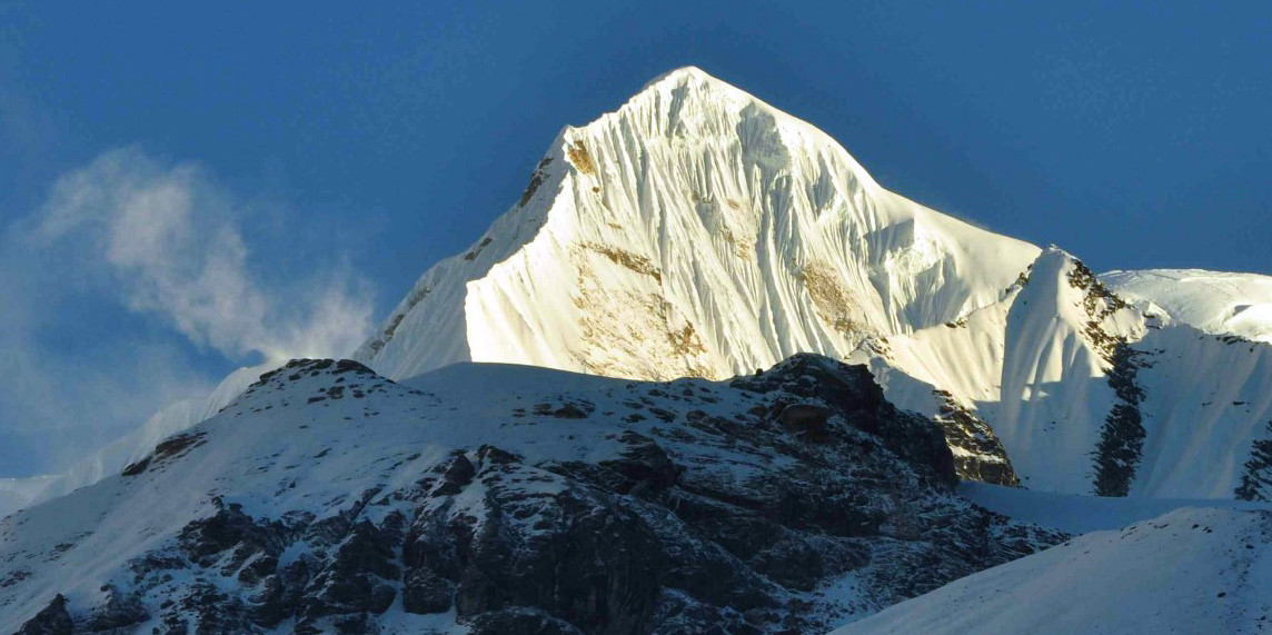
Elevation- (5663m/18,579ft)
Location - Annapurna Region
Grade – moderately difficult
Best Time - Autumn (October-November) and Spring (April-May)
Coordinates - 28°35'05'' N / 83°55'50''E
Himalayan View - Annapurna Massif, Gandharva Chuli, and Macchapucchre (Fishtail)
Yala Peak(5732m/18,790ft)
Yala Peak is one of the most simple and easiest peaks for climbing at the height of (5732m/18,790ft) located in the Langtang region. Yala Peak is a great beginning climb and should be your first Himalayan peak if you're new to the area. Yala Peak is ideal for learning how to use an ice axe, crampons, ascend and descend fixed ropes, and perform crevasse rescue. Climbing Yala Peak is a reasonably easy and non-technical climb. The mountain is located near Ruswa at 28°14'24"N and 85°37'32"E. Yala peak climbing is ideal in the spring and fall, which includes the months of April, May, September, October, and November. This summit, however, can be climbed in the winter. The Yala summit is well-known for providing a great view of Shishapangma (8013m). Shishapangma is Tibet's tallest holy mountain, as well as the lowest of the 14 8,000-meter peaks.
The path leading to Yala Peak passes past agriculture, villages, forests, and rivers. During your hike, you'll pass through gorgeous rhododendron, pine, and bamboo forests, as well as various species of unique flowers. After passing through this breathtaking environment, you'll enter the Langtang River's narrow gorge and soon ascend to the Langtang (3500m/11,483ft) and Kyanjin Gumba (3800m/12,467ft) alpine grasslands. The glacier and the meadow converge at this spot. Yaks graze in the foreground, with the snowy peaks of Langtang Ri, Langtang Lirung, Dorjee Lakpa, and many other climbed and nameless mountains in the background.
You can visit the Langtang National Park, which is home to various Tamang tribes, on your way up to Yala Peak. You will hike to the Base Camp (4800m/15,748ft) from the base camp after acclimatizing at Tserko-re and witnessing the glacier. Many spectacular peaks, including Langtang Lirung (7246m/23,772ft), Lenpo Gang 7083m/23,238ft), and Dorje Lakpa (6990m/22,933ft), will be visible. Yala peak climbing is recommended for trekkers and climbers who desire to stand atop a Himalayan peak but only have a limited amount of time and are new to mountaineering.
Elevation - (5732m/18,790ft)
Location - Langtang Region
Grade - Easy Climb
Best Time - Autumn (October-November) and Spring (April-May)
Coordinates - 28°14'0924'' N / 85°37'33''E
Himalayan View - Langtang-re, Luri Himal, Langtang Lirung and Shishapangma
Mardi Himal Peak (5587m/18,330ft)
The Annapurna region's Mardi Himal, at 5587m/18,330ft, is situated alongside the holy peak of Fishtail, or Mt. Machhapuchhare. It's only about fifteen miles north of Pokhara as the crow flies. It is the Annapurna range's farthest southerly mountain. It is the lowest of Nepal's trekking peaks, and arguably the least climbed or visited. The Mardi Himal Trek is a freshly opened route in the Annapurna region that is a hidden gem. The primary route ascends the East Face via snowy terrain to a col at 5200 meters.
From Kathmandu (1400m/4600ft) to Lukla (827m/2713ft), then to Potana (1950m), Forest Camp (2500m/8202ft), Low Camp (2990m/9809ft), and High Camp (3580m/11,745ft), base camp (4450m/14,599ft) if you take the caravan route. 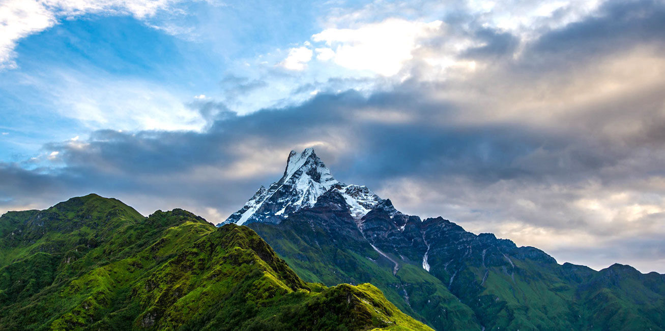
Elevation - (5587m/18,330ft)
Location - Annapurna Region/ Himal
Grade – Difficult
Best Time - Autumn (October-November) and Spring (April-May)
Coordinates - 27°59'17'' N / 86°55'31''E
Himalayan View - Annapurna I, Hiunchuli and Macchapucchre (Fishtail)
Chhukung Ri Peak (5550m/18208ft)
Chukkung Ri (5550m/18,208ft) is a rocky mountain above the village of Chhukung, comparable to Kala Pataar; and this peak is used as an acclimatization ascent by groups preparing to climb Imja Tse, particularly if they haven't been to Everest Base Camp or Kala Pattar. The summit is modest by Himalayan standards and requires no technical expertise, only endurance.
The caravan journey begins in Kathmandu (1400 meters/4600 feet) with a flight to Lukla (2860 meters/9383 feet). Phakding (8,562ft/2610m) 2 nights in Namche Bazaar (3440m/11,286ft) Tengboche (3250m/10,660ft) is the highest point in Tibet. Pangboche (3985 m/13,074ft) is the highest peak in Tibet. Pheriche (14,340ft/4371m) Dingboche (4410m/14,468ft) (2 nights).
The climb itself is relatively short, taking only 2-5 hours from Chhukung village. Starting from the town, it takes around 2 hours to climb to the saddle via well-defined pathways marked with cairns. Turn left on an easy path to the lower top once you've reached the saddle. For the main panel, turn right and traverse along the ridge, which is covered in loose scree and shattered boulders. The trail might be difficult to find at times and is fairly steep. From the saddle to the peak, allow 45 minutes to an hour.
Elevation - (5550m/18208ft)
Location - Khumbu Region
Grade - Easy trekking peak
Best Time - Autumn (October-November) and Spring (April-May)
Coordinates - 27°56'20'' N / 86°52'38''E
Himalayan View - Mount Lhotse, Mount Pumori, and Mount Ama Dablam
For the Nepal Tour, please click here.
If you are looking for different kinds of Nepal Packages, feel free to contact us.